
There’s a new Fire Hazard Severity Zone (FHSZ) designation called Local Responsibility Area, or LRA. You might already be familiar with State Responsibility Area, or SRA. But if this is all new to you and you’re wondering what the heck a FHSZ is, read on.
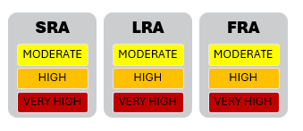
Fire Hazard Severity Zones, or FHSZ, are geographic areas classified based on the potential risk of wildfire. The classifications—Moderate, High, and Very High—are determined by factors such as:
- Vegetation type and density
- Topography and slope
- Climate and weather patterns
- Historical fire data
In California, the responsibility for fire protection and mitigation are divided between the federal, state, and local responsibility areas:
Federal Responsibility Areas (FRA) – the federal government, such as the US Forest Service, manages areas owned by the US government.
State Responsibility Areas (SRA) – the state of California (CAL FIRE) manages the SRA, which cover many rural areas and state-owned land. SRA covers most of the Santa Cruz Mountains.
Local Responsibility Areas (LRA) – local governments and fire agencies cover the LRA, which include incorporated cities and urban regions that aren’t in SRA or FRA.
Within each responsibility area are the three fire hazard severity zones mentioned above: Moderate, High, and Very High.
Here’s what you need to remember:
No matter which area your property is in, SRA or LRA, the HIGH and VERY HIGH fire severity zones are subject to the same real estate disclosure requirements which include defensible space and home hardening features.
2025 Updates to LRA FHSZ Maps
In 2025, the Office of the State Fire Marshal (OSFM) released updated FHSZ maps for LRAs across California. These updates incorporate the latest scientific data and modeling techniques to more accurately reflect wildfire hazards.
When does it become part of the required disclosures?
The maps showing LRA zones are available for viewing here, but they have not yet been officially adopted. Below are dates for areas within Santa Cruz County when LRA maps will be adopted:
City of Scotts Valley: May 8, 2025
Central Fire District: June 11, 2025
City of Santa Cruz: June 28, 2025
How does being in an LRA affect insurance?
Homeowner’s insurance companies use many types of criteria to determine eligibility and coverage. These criteria aren’t typically based on fire hazard maps only, but many other factors, including terrain, climate, road access, and structural materials. Many Insurance companies offer discounted rates for property owners that have defensible space compliance and have installed home hardening features. To find out more about that, go here.
?
If you still have questions about LRA, SRA, or anything else about fire hazard severity zones, please get in touch with us! We are always happy to help. We want to keep you informed so you can provide the best service to your clients.

Chris has over 23 years of experience in Natural Hazard Disclosure reporting. GeoDisclosure has been a great success because Chris believes that having a responsive and reliable service is the number one.