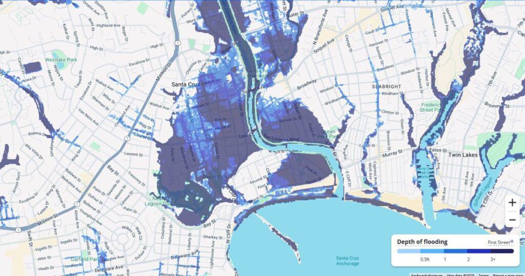
This topic got my attention recently because I have been receiving calls from real estate agents asking me to explain where these predictive hazards reports come from and what do they mean. Their clients are asking these questions, so the agents are reaching out to their local natural hazard expert like me for help.

These natural hazard prediction reports come with the name Flood Factor, Fire Factor, Air Factor, Wind Factor, and Heat Factor and they are showing up on the big on-line listing websites such as Zillow, Redfin, Realtor.com. Let me tell you what I know about these climate hazard prediction reports and what they mean.
The company that produces these reports is called First Street Foundation, and they are in the business of climate risk financial modeling for properties in the United States. First Street uses sophisticated data crunching techniques that synthesize existing large-scale climate studies to predict future climate risk at a zoomed in, local level of future climate related hazardous impacts of individual properties. These data crunching techniques they use are complex and fascinates me from an earth scientist’s perspective, but from what I can tell by reading their methodology used for creating their reports, this can introduce many errors and should be taken with a large interpretive grain of salt.
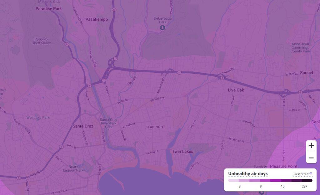
One example is, according to First Street is that Santa Cruz County will have extremely poor air quality over the next 30 years assuming wildfire activity will continue at its current rate.

But more importantly, one should be concerned about the information contained in these reports because it is receiving much attention and could have an outsized influence on how financial institutions see property values.
Banks, insurance companies, and governmental agencies are all relying on this predictive information to make decisions on future property values.
As a result, insurance companies are raising premiums. In some places, properties are uninsurable. Lenders are devaluating properties in advance of these potential predicted hazards. Banks are using this information to decide on which loans to approve. A new trend is happening with the creation of “climate abandonment zones” where people are moving based on predicted risk and availability of financial services. This can have a massive impact on property values in certain areas, can alter neighborhood composition, and affect commercial viability of cities, towns, and neighborhoods both positively and negatively.
My concerns are the lack of accuracy of these reports and that major financial players are heavily relying on this one “authoritative” source of predictive information. Predictive climate change modeling is not developed enough to have such an impact on the homeowner’s property values. First Street does have this disclaimer in their products…
“First Street models are designed to approximate risk and not intended to include all possible scenarios.” That is a clear message that we are not yet ready for AI to have this kind of impact on society.
1 Comments

Chris has over 23 years of experience in Natural Hazard Disclosure reporting. GeoDisclosure has been a great success because Chris believes that having a responsive and reliable service is the number one.

Really helpful info and overview, thanks Chris.